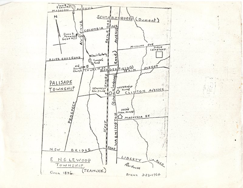
Hand drawn area map featuring local landmarks and slave cemetery
Title
Hand drawn area map featuring local landmarks and slave cemetery
Subject
Map of Bergenfield
Description
A hand drawn map of major streets in Bergenfield. Includes the location of the African American Baptist Church Cemetery, labeled as the "slave cemetery," in relation to major streets in and around Bergenfield.
Date
March 23 1964
Format
jpg
Type
Image
Citation
“Hand drawn area map featuring local landmarks and slave cemetery,” Local History, accessed February 20, 2026, https://bergenfieldlibrary.org/localhistory/items/show/858.
